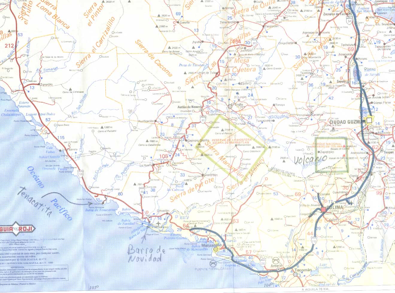
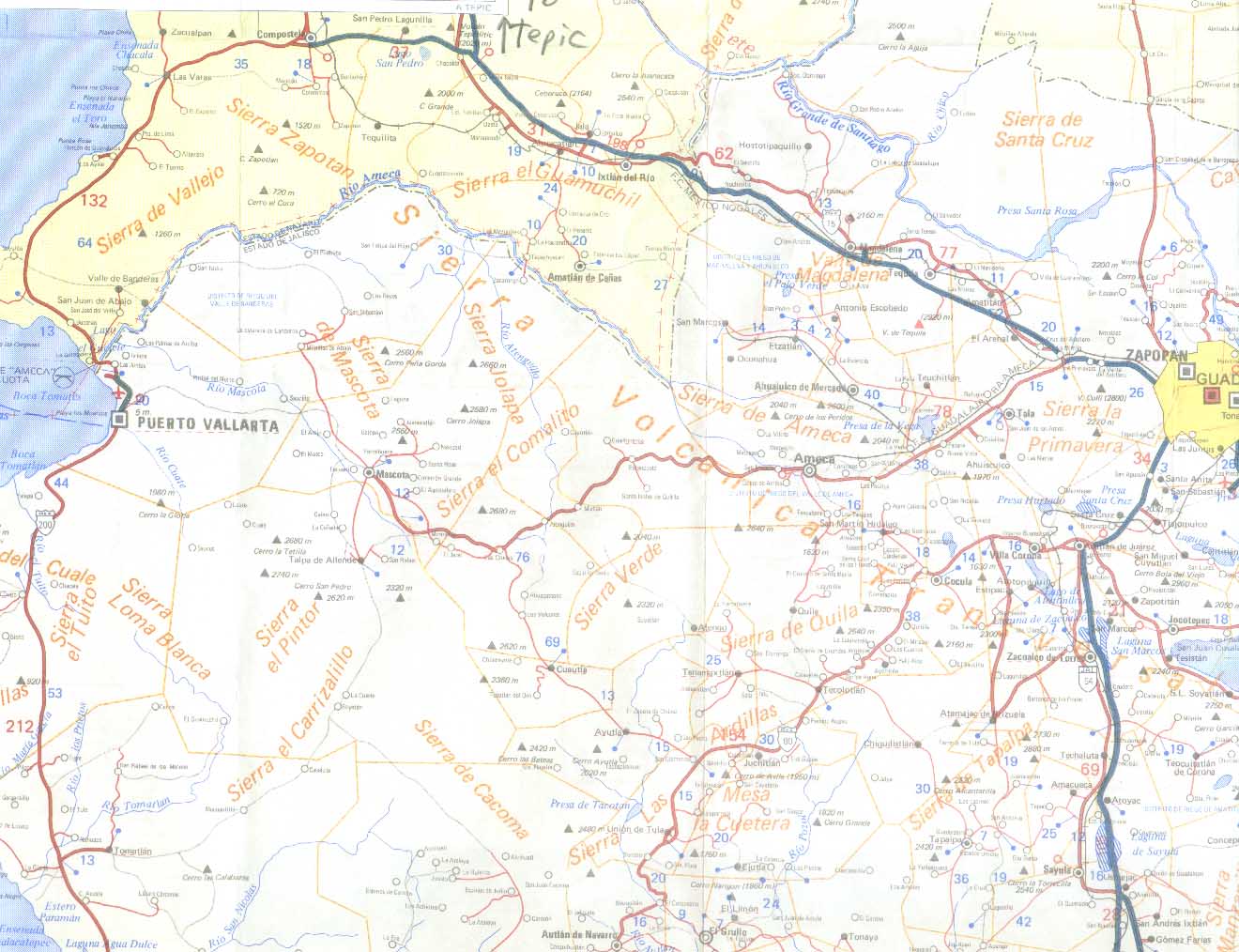
Map of the loop from Puerto Vallarta to Guadalajara to Barra de Navidad (or Tenacatita ) and back to Guadalajara - two maps are included to show the whole route. Click on the small maps below to make them big. Put your mouse arrow over the map to read the caption.
El mapa del lazo del Puerto Vallarta a Guadalajara a Barra de Navidad (o Tenacatita) y la espalda a Guadalajara - dos mapas se incluyen para mostrar la ruta entera. El chasquido en los mapas pequeños debajo de hacerlos grande. Ponga su flecha de ratón sobre el mapa para leer el título.
Tenacatita is a small beachfront settlement located about 27 miles northwest of Barra de Navidad. A 9km paved road leads from the intersection with coastal highway 200 (GPS 19°20.78'N 104°52.75'W) to Tenacatita. It's 30km from the highway intersection to Melaque.
Highway 200 is the coastal highway or Carretera Costera. It runs near the Pacific coast from the state of Nayarit through Jalisco, Colima, Michoacán, Guerrero, Oaxaca, and Chiapas to the Guatemala border.The highway, a nice road winding through jungle growth, is often damaged by heavy rains that may occur during the months of August - October. Maintenance workers will quickly make the road passable again since it is a lifeline to the coastal communities.

La carretera 200 son la carretera costera o Carretera Costera. Corre cerca de la costa Pacífica del estado de Nayarit por Jalisco, por Colima, por Michoacán, por Guerrero, por Oaxaca, y por Chiapas a la frontera de Guatemala. Tenacatita es un arreglo pequeño de beachfront localizado acerca de 27 noroeste de millas de Barra de Navidad. Un 9 km camino pavimentado dirige del cruce con carretera costera 200 (GPS 19°20.78'N 104°52.75'W) a Tenacatita. Es 30 km del cruce de carretera a Melaque. La carretera es un camino bueno pero a menudo dañado por aguaceros recio que puede ocurrir durante los meses de agosto - octubre. Los trabajadores de la conservación harán rápidamente el camino pasable otra vez desde que es una cuerda salvavidas a las comunidades costeras.
back to tenacatita homepage apoye al homepage de Tenacatita